
Cazorla
Cazorla lies at an elevation of 836 metres on the western slope of the Sierra de Cazorla. It is the entry point and base for visits to the Natural Park of Sierras de Cazorla, Segura y Las Villas Natural Park, a vast protected area of magnificent river gorges and forests. Spain's second longest river, the Guadalquivir, has its source in the mountains to the south of the settlement.
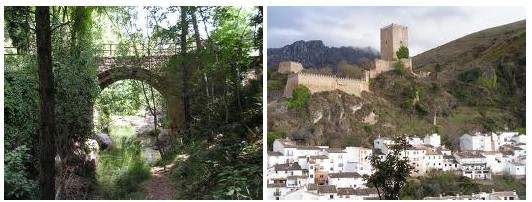
The town is constructed around three main squares, the Plaza de la Constitución, the Plaza de la Corredera (or de Huevo, "of the Egg", because of its shape), and the Plaza Santa Maria. This last square is the oldest and is connected to the other two by narrow, twisting streets. It takes its name from the old cathedral which, damaged by floods in the seventeenth century, was later burnt by French troops. It is now in ruin. Above the square sits an austere, reconstructed Moorish castle tower called La Yedra. Still higher up on the rocky escarpment lie the ruins of still yet another ruined fortress.


